Next Up

I’m working on several projects and hope to finish two within the next few months.

First, I am finishing up the “Maps of the Peninsula and Seven Days.” There will be about 120 map sets, beginning with Fortress Monroe and the fight at Big Bethel. The book will then cover Yorktown, Williamsburg, Seven Pines/Fair Oaks Station, Hanover Junction, and the Seven Days Battles. It will feature several well-known generals, such as McClellan, Johnston, and Lee. It will be the 10th book in the maps series. It should be available in late 2026 or early 2027.

I am proofing the manuscript and awaiting comments from reviewers before I send it to Savas Beatie for editing.

I am also again working with Linda on a smallish book that examines the relationship between Grant and Meade during the Overland and Petersburg Campaigns. Fascinating stuff. The book should be available in 2026.

After I have completed these activities, I will get back to writing “The Maps of Chancellorsville,”

Busy Times

My wife always tells me I should post more on this site, but between tours and trips to Civil War Round Tables, I have been very busy.

During the past few months I have ventured far and wide to give talks.

It started in May when I visited the largest Civil War Round Table in the country– the Brunswick CWRT that boasts over 1200 members. The meeting was held in a large mega church, and my talk attracted over 400 members.

In October, Linda and I embarked on a road trip to New England. Here was the itinerary:

  • October 8: Merrimack CWRT (Salisbury MA)
  • October 9: Joshua Chamberlain CWRT (Brunswick ME)
  • October 10: The Civil War Round Table of New Hampshire (Epping, NH)
  • October 11: Green Mountain CWRT (VT)

After a few day’s rest, we headed to Scottsdale Arizona to speak that their round table (big!).

If that wasn’t enough, we headed to East Tennessee for three presentations there:

  • November 10: Kingsport CWRT
  • November 11: Knoxville CWRT
  • November 12: Cumberland Mt. CWRT (Crossville)

We are done for awhile!

Here are a few photos:

Here I am speaking to the Knoxville CWRT

A photo of the audience at the Cumberland Mountain CWRT– big group– photo doesn’t do it justice.

As always, Linda, was a constant companion. Don’t know what I would do without her!

Correction

I am no longer giving Harpers Ferry tours. As an Antietam Certified Battlefield Guide I can give Maryland Campaign tours of Bolivar Heights and Camp Hill. However, I learned last month that if I go into Old Town (or give the battlefield components of Harpers Ferry outside of an Antietam tour), I must have a Commercial Use Permit. I wrote to the ranger in charge of these permits at Harpers Ferry and he confirmed it, so I asked him about how I would go about securing such a permit, but have not heard back from him– I suspect because of the cuts to the NPS budget. I have stopped giving Harpers Ferry tours for compensation, as I respect the NPS’ regulations.

I was only going to provide 1-2 Harpers Ferry tours a month, so it is probably not worth going through the process and expense anyway. I am also not interested in becoming a Harpers Ferry Licensed Guide for that reason.

Bottom line, if you want a full Harpers Ferry tour, contact their bookstore. If you want to join me on a non-paid stroll down the streets of Harpers Ferry, well, I can still do that.

Tours

This has been a busy summer as I am giving lots of tours. In addition to Antietam battlefield tours (as a Certified Antietam Battlefield Guide) and Gettysburg Town Tours (as a Gettysburg Licensed Town Guide), I am now giving Harpers Ferry Tours.

Harpers Ferry is such a neat place to visit, but unfortunately, few who visit ever see the “real” Harpers Ferry. That includes Storer College– the first African-American college in America, Camp Hill and the Bolivar battlefield. Most head over to the Old Town, but how many see the remains of the old Cotton Mill along the Shenandoah River, hear the story of how Merriweather Lewis visited Harpers Ferry, or the floods that ravaged the town, and the many odd and wonderful folks who made Harpers Ferry special, such as Peter Stevens, Robert Hall, John Hall, Nathan Brackett, and of course John Brown.

Contact me if you are interested in one of the tours I mentioned above. With my ongoing back issues, I am not giving longer walking tours, but hopefully, next year.

Fixing Second Bull Run

Those of you who have purchased my Second Bull Run book may have noted that it is smaller than others in the series. Here’s what it looks like on my self:

I was able to fix this in a simple way:

I took some cardboard strips and placed it under the book on the shelf. It now looks like this.

It may not bother you, but I like all of my map books to be the same height. Can you tell which ones I have pulled out for research purposes? Hint– one is from 1862 and the other from 1864.

Number 23

Ted Savas just send me some copies of my newest book: The Overland Campaign for Richmond: Grant vs Lee, 1864. It is a small volume in the Casemate series on the Civil War with lots of photos and graphics. I was also able to use some of my maps.

Hope you enjoy it!

A National Award!

I was delighted to learn that my Maps of Spotsylvania through Cold Harbor book received the 2023 Army Historical Foundation Distinguished Writing Award in the “Reference” category.

I have won several smaller awards for my writing, but this is my first national award.

I have almost completed the first draft of my Maps of the Peninsula and Seven Days Campaigns and then onto the Maps of Chancellorsville!

Maps of Second Bull Run Now Available!

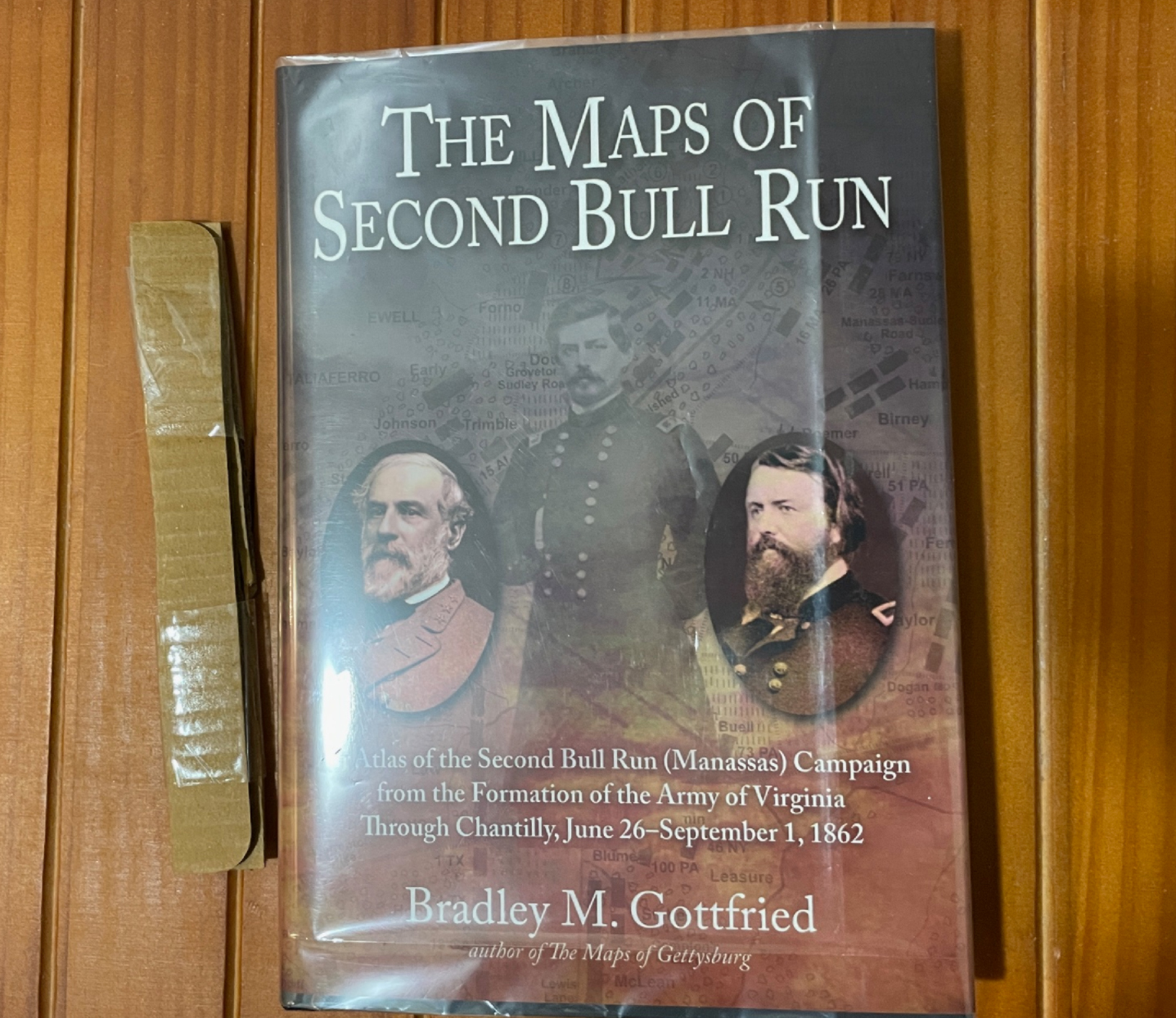
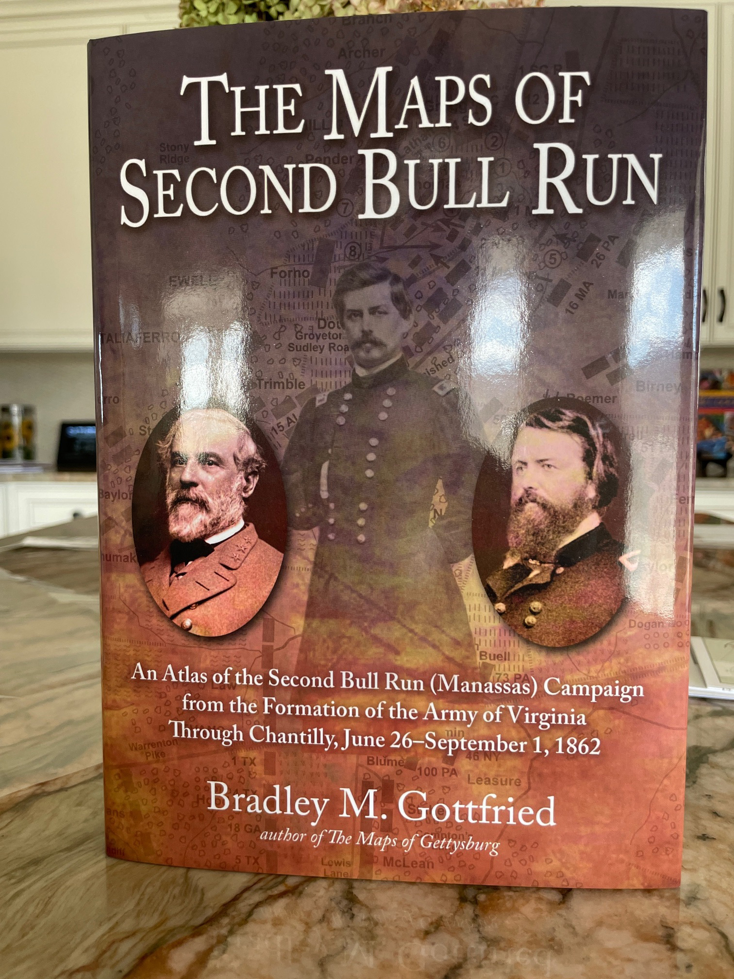
I am very pleased to announce that the ninth book in my “map series” has now been published by Savas Beatie. It came out very nicely, except it is a bit smaller than the other volumes.

The book contains 122 full-color maps with a description on the facing page– as with all of my map books. It begins with the formation of the Army of Virginia and ends with Chantilly.

I have copies that I can sell for $35 (list is $40) plus $6 shipping. Let me know if you are interested.

This one was especially tough, as two distinguished authors, John Hennessey and Scott Patchan, both of whom I respect greatly, differed on a major portion of the battle. Unable to decide which author to follow, I asked Jim Burgess at Manassas National Military Park and he set me straight.

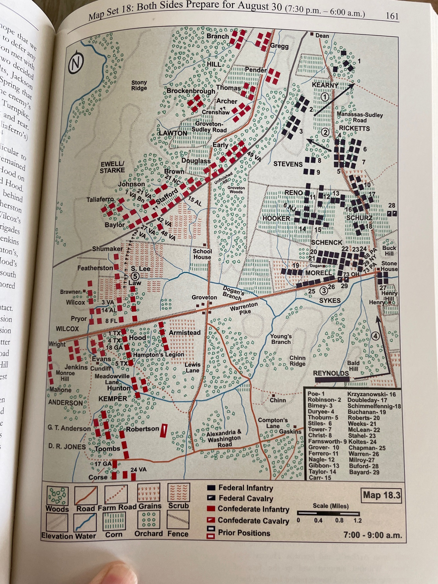
Here is an example of one of the maps:

Here is the publicity blurb:

The Maps of Second Bull Run: An Atlas of the Second Bull Run (Manassas) Campaign from the Formation of the Army of Virginia Through Chantilly, June 26–September 1, 1862 continues Bradley M. Gottfried’s efforts to study and illustrate the major campaigns of the Civil War. This is the tenth book in the ongoing Savas Beatie Military Atlas Series.

President Abraham Lincoln’s frustration with George B. McClellan’s inability to defeat Robert E. Lee and capture Richmond dramatically increased after the unsuccessful Seven Days’ Battles. In response, Lincoln combined three small armies into the new Army of Virginia and placed it under Maj. Gen. John Pope, who had overseen several successes in the Western Theater.

Pope’s aggressiveness and McClellan’s passivity on the Peninsula convinced Lee to send Thomas “Stonewall” Jackson’s wing of the Army of Northern Virginia to confront Pope. A bloody battle at Cedar Mountain on August 9 halted Pope’s move south, and Jackson’s raid on the vast stores at Manassas Junction triggered another confrontation, this time at Kettle Run.

When McClellan’s troops abandoned the Peninsula, Lee moved his other wing under James Longstreet rapidly north. Pope missed an opportunity to prevent the junction of Lee’s wings by not stopping Longstreet at Thoroughfare Gap.

The battle of Second Bull Run began on the evening of August 28 when Jackson tangled with Union troops at the Brawner Farm. Pope spent much of the next day hammering Jackson’s front, with no idea that Longstreet was arriving on the field. The Union assaults continued on August 30 until Longstreet launched a massive assault that rolled up the Union left flank and collapsed Pope’s army. The retreat was briefly interrupted by some of Jackson’s units at Chantilly, which ended the campaign.

The Maps of Second Bull Run plows new ground by breaking down the entire campaign into 24 map sets or “action sections,” enriched with 122 detailed full-page color maps. These cartographic originals bore down to the regimental and battery level. They include the march to and from the battlefields and virtually every significant event in between, including cavalry actions. At least two—and as many as ten—maps accompany each map set. Keyed to each piece of cartography is a full-facing page of detailed text describing the units, personalities, movements, and combat (including quotes from eyewitnesses) depicted on the accompanying map, all of which make the cavalry actions come alive.

This presentation allows readers to easily find a map and text on any portion of the sprawling campaign. Serious students will appreciate the extensive endnotes and complete orders of battle and take the book with them to the battlefields. A final bonus is that the maps unlock every other book or article written on any aspect of the campaign.

Perfect for the easy chair or for stomping the hallowed grounds, The Maps of Second Bull Run is a seminal work that belongs on the bookshelf of every serious and casual student of the battle.

“Race to the Potomac” has been published!

As you can see from the cover, our new book covers the action from the time the armies leave Gettysburg until Lee’s wounded army finally crosses the Potomac.

As with all Emerging Civil War books, this is not meant to be an exhaustive study– there are other good ones for that. In the almost 170 pages, we highlight, on a day by day basis, the events that occurred during the retreat. It is also loaded with illustrations and maps. We consider this a “gateway book.” It may be all one needs to know or it may lead the reader to other, more in-depth treatments.

Although I have studied the retreat for years, you really don’t quite understand a topic until you write about it. John Imboden has become one of my heroes because of how he handled the thankless job of getting a 17-mile wagon train filled with wounded Confederate soldiers to the “safety” of the Potomac River. Along the way, he was forced to deal with attacks on the wagons, breakdowns, and of course, the screams of the wounded, many who prayed they would quickly die.

Lee does a very good job of getting his army to safety with minimal additional losses, and Jeb Stuart tries to redeem himself by effectively guarding Lee’s flanks at Hagerstown.

Meade gets his share of accolades. In command for only three days prior to the battle, Meade was naturally cautious about Lee’s intentions and routes. He probably did as well as any general in following Lee without inflicting serious losses on his already wounded army.

I am not a fan of Judson Kilpatrick, but he did a pretty good job of capturing wagons at Monterey Pass and Leitersburg. There were many other actors, but these tend to stand out.

The retreat was loaded with small-scale fights– mainly cavalry actions at Smithsburg, Boonsboro, Funkstown, and Falling Waters.

I can’t end this post without thanks to series editor, Chris Mackowski and to Thomas J. Ryan and Richard R. Schaus, who generously allowed me to use their wonderful Hal Jesperson maps that they included in their fine book, “Lee is Trapped and Must be Taken.”

Hope you enjoy the book!